101 How To Plan A Construction Site Soil Investigations Program
Courses > Soil Mechanics > Geotechnical Laboratory and In-Situ Testing Methods > 101 How To Plan A Construction Site Soil Investigations Program Introduction
The article presents the latest methodologies in the planning, execution, and interpretation of the various exploratory investigation methods, and the development of appropriate soil and rock parameters for engineering applications.
The proper discharge of the geotechnical engineerís duties requires that he or she be involved from the very beginning of the planning stage of a project. A geotechnical engineer may provide, based on prior knowledge
and research for example, guidance in the location of a proposed tunnel or road which may result in reduced cost, improved constructibility and other advantages. When the services of the geotechnical engineer are introduced into the project after the final project location is determined, a very important value engineering benefit may be missed.
 Concepts and Formulas
Site Characterization - Strategy
A step by step strategy for site characterization is summarized below:
- Obtain an understanding of the potential geologic and geotechnical conditions of the proposed site by reviewing regional studies. Also, consult with other professionals who have worked in the area to obtain their opinion regarding potential conditions and issues at the site.
- Obtain aerial photography (historical and recent), geologic and soil maps and other sources of subsurface information.
- Obtain drawing of the facilities planned for construction including the footprint of the building, foundation locations, areas of cut and fill, utilities, property lines, etc.
- From this information, develop a first phase of the investigation to improve your understanding of key issues and obtain the data necessary to complete preliminary engineering analyses.
- Perform the assessment and calculations of the phase 1 data to understand the sensitivity of the analyses to key soil and groundwater input. The potential range of outcomes should be estimated by varying the key inputs within the possible ranges suggested by the characterization data.
- From the phase 1 assessment, decide if the conditions at the site and the performance of the geosystem fall with the following categories:
- Safe or adequate performance expected
- unsafe or with inadequate performance likely
- unknown condition or performance
- In case, 6.1., decided if additional data or analyses are needed, if any, to complete the design. For case 6.2., decide what design modification and/ or ground improvement is necessary to obtain acceptable performance. In some cases, other foundation types and construction methods will need to be used. In a few instances, the planned site will have to be abandoned and another location selected. For case 6.3., decide what key conditions must be better defined to complete the design and plan a phase II investigation.
Existing Data Sources
The first step in the investigation process is the review of existing data. There are a number of very helpful sources of data that can and should be used in planning subsurface investigations. Review of this information can often minimize surprises in the field, assist in determining boring locations and depths, and provide very valuable geologic and historical information which may have to be included in the geotechnical report.
Following is a partial list of useful sources of geological, historical, and topographic information:
- Prior subsurface investigations (historical data) at or near the project site.
- Prior construction and records of structural performance problems at the site (i.e. pile length, driveability problems, rock slides, excessive seepage, unpredicted settlement, and other information). Some of this information may only be available in anecdotal forms. The more serious ones should be investigated, documented if possible, and evaluated by the engineer.
- U.S. Geological Survey (USGS) maps, reports, publications, and websites (www.usgs.gov).
- State Geological Survey maps, reports, and publications.
- State flood zone maps prepared by state or U.S. Geological Survey or the Federal Emergency Management Agency (FEMA: www.fema.gov) can be obtained from local or regional offices of these agencies.
- Department of Agriculture Soil Conservation Service (SCS) Soil Maps - A list of published soil surveys is issued annually. It should be noted that these are well researched maps but they only provide detailed information for shallow surficial deposits. They may show frost penetration depths, drainage characteristics, USDS soil types, and agrarian data.
- Geological Societies (Association of Engineering Geologists, Association of American State Geologists).
- Local university libraries and geology departments.
- Public Libraries and the Library of Congress.
- Earthquake data, seismic hazards maps, fault maps, and related information prepared by:
- U.S. Geological Survey (USGS).
- Earthquake Engineering Research Center (EERC), University of California, Berkeley.
- Earthquake Engineering Research Institute (EERI), Stanford University
- National Earthquake Engineering Research Program (NEERP), Washington, D.C.
- Multidisciplinary Center of Earthquake Engineering Research (MCEER), Buffalo, N.Y.
- Advanced Technology Council (ATC), Redwood City, California
- Mid-America Earthquake Center (MAEC), Univ. of Illinois, Urbana.
- Pacific Earthquake Engineering Center (PEER), Univ. of California-Berkeley.
- Worldwide National Earth-Science Agencies
- U.S. Bureau of Mines (USBM)
- State, City, and County Road Maps
- Aerial Photographs (USGS, SCS, Earth Resource Observation System).
- Remote Sensing Images (LANDSAT, Skylab, NASA)
- Site Plans showing locations of ditches, driveways, culverts, utilities, and pipelines.
- Maps of streams, rivers and other water bodies to be crossed by bridges, culverts, etc., including
bathimetric data.
The majority of the above information can be obtained from commercial sources (i.e. duplicating services) or U.S. and state government local or regional offices. Specific sources (toll free phone numbers, addresses etc.) for flood and geologic maps, aerial photographs, USDA soil surveys, can be very quickly identified through the Internet.
Review of Proposal
The initial step of a field exploration is the review of the project proposal or work plan and a discussion of the project’s scope and objectives of the Project Manager. This initial meeting provides the basis for completion of the fieldwork and is the time to raise any questions regarding scope, procedures, schedule, and any other issues that are not clearly understood. Particular attention should be given to:
- Project budget
- Goals, objectives, and scope of the field exploration
- Sampling procedures and sample requirements for laboratory testing
- Criteria for the final depth of borings
- Site access and client contacts
- Utility clearance
- Permits and security
- Health and safety
- Disposal of cuttings and drilling fluids
- Site trafficability and access
- Site restoration requirements
- Methods to locate borings
- Closure of borings
- Traffic control
- Applicable standards [American Society for Testing and Materials (ASTM), etc.] to be implemented
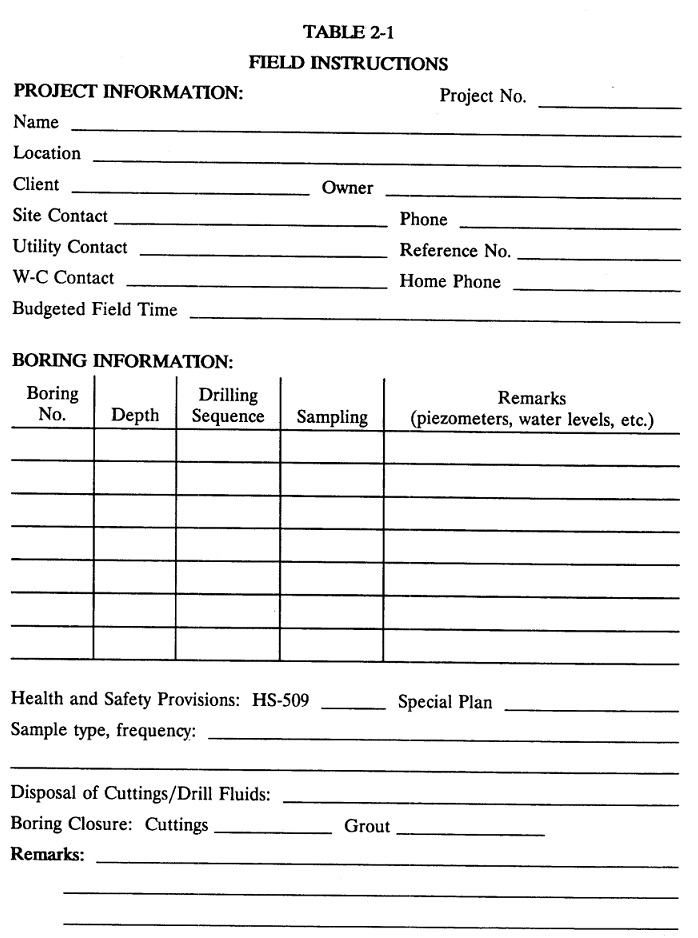
The figure below presents a field instructions form to assist the Field Representative (and the Project Manager) in the field exploration.
Site Exploration Planning
Planning for the site exploration must first address a general understanding of the topographic and geologic conditions at the site. Information sources include:
- United States Geological Survey (USGS) 7½ Minute Quadrangle Maps,
- United States Department of Agriculture (USDA) Soil Surveys,
- published geologic maps
- previous borings on the project site or adjoining sites
This review will help guide selection of the type of field exploration methods and the expected extent of the exploration. In some instances, borings may not be the appropriate exploration tool. Site reconnaissance and mapping, shallow hand probes, test pits, or geophysical tools may provide the necessary information without the disruption and cost incurred by borings. If borings are needed, the planning must address the type and diameter of the borings and the type and number of samples.
Site Visit / Plan-in-Hand
It is almost always necessary (and desirable) to visit the project site prior to initiating field activities. The following is a list of the items that should be checked during the site visit.
- Verification of site location
- General access for equipment (truck, drill rig)
- Height restrictions (power lines, overhang)
- Slope at locations where field activities are planned
- Availability of water and power
- Type and thickness of pavement (if present)
- Restrictions on working hours
- Locked gates, access to keys
- Security passes or entry permits required to enter the site
- Traffic directions and routes at the site, traffic control
- Other permits required for drilling in the Street or on public property
- Location of underground and overhead utilities
- Verification of planned method to locate borings (staking by surveyor, taping from existing features)
During site reconnaissance, the planned location(s) of the exploration point(s) should be visited and suitable locations should be determined for:
- Storage of materials and supplies
- Storage and disposal of residuals (cuttings and drilling fluid)
Where possible, these locations should be approved by the client representative and should be selected to minimize interference with client activities and damage, while providing appropriate safety and security.
After the site visit, a field report documenting the observations, conversations, and other pertinent information gathered during the reconnaissance should be prepared by the field personnel and given to the Project Manager. If possible, the client’s field representative should receive and sign a copy of the field report.
Underground Structures and Utilities
Location of underground utilities and structures can be located by the following:
- Information from client
- Site visit (obvious outlets, filling lines, and pumps for underground tanks)
- Geophysical surveys
- Underground alert services (see local, telephone directory - buried cable listing); if not available, contact individual utility companies
- Excavations to expose utility lines (potholing)
It is extremely important that the boring locations be cleared for utilities prior to beginning the first boring. Underground alert services generally must be contacted at least two working days prior to the commencement of fieldwork. The underground alert service will notify affiliate companies that have underground utilities in the project area. The individual companies will send representatives to the site to check utility locations. The locations of borings, pits, etc., must be marked (often with white paint) prior to the utility clearance or arrangements must be made to meet the alert service personnel. The following information is generally required:
- Exact location of project site, including Street address and nearest cross street
- Type of work
- Client name
- Your company name and contact person (give a primary contact and a backup
- contact)
- Date of fieldwork
- Other pertinent instructions (such as site access)
- Date and time of the on-site meeting (if required)
The alert service will provide a ticket number and list of companies that the alert service will notify. This information should be recorded for future reference. It should be noted that there are companies and agencies which are
not members of alert services and the alert service may not provide information regarding all underground lines and structures (for example, city sewer lines). Any utility companies not contacted by the alert service should
also, be contacted. In addition, the alert services do not have maps of underground utilities on most private properties; they typically mark the underground utility location to the point where it enters private property.
Permits
The time and cost involved in obtaining permits for regulatory and public agencies can place substantial constraints on the performance of a project if not adequately addressed in the planning stages. It is important to acquire all necessary permits for access, drilling, sampling, and well construction in a systematic, timely manner.
As a first step in obtaining required permits, it is necessary to identify private and public agencies that might have permitting requirements. ]Private clients commonly provide us with the permit and access to the property for sampling and other required field activities. Public clients commonly require geotechnical firms obtain permits and to coordinate site access. When obtaining permits, make certain that geotechnical is not assuming any liability that should be the client's.
Equipment and Supplies
The geotechnical Field Representative must take all forms, scales, testing equipment, and marking pens needed to prepare the boring logs and to mark the sample containers. This equipment must be with the Field Representative or arrangements must be made to have the driller provide the equipment.
Each project will require a specific type and amount of specialized equipment, supplies, and materials. In-house equipment should be requested at least one day prior to the commencement of field activities. All equipment must be inspected, the batteries charged, calibrated, and properly signed for prior to mobilization for the project.
 Watch Videos
 Solved sample problems
 Download Files
 Read also
- 101 How to Write a Geotechnical Report
- What is Geotechnical Engineering? Subtopics, Salaries, Books, Journals, ...
- Top software for Geotechnical Engineers
- Example of Site Layout Planning
- How could artificial intelligence help in optimization of steel at construction site?
 Share
Share
Follow our official Facebook page (@civilengineeringbible) and Twitter page (@CivilEngBible) and do not miss the best civil engineering tools and articles!